 Catalogue DataGrandEst
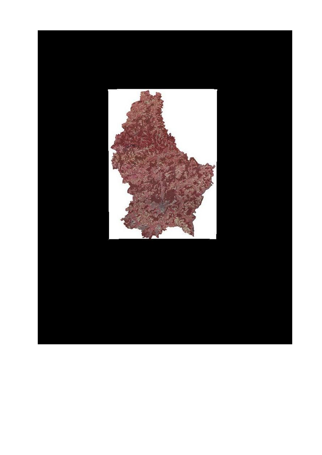
Air and satellite image - orthophoto 2016 infrared
This layer contains the infrared version of the orthophoto 2016.
Simple
- Date (Creation)
- 2017-01-18T00:00:00
- Date (Revision)
- 2017-01-18T00:00:00
- Citation identifier
- / c313da75-7d8b-4570-9db5-bb6add56309e
- Presentation form
- Digital map
- Status
- On going
- Point of contact
-
Organisation name Individual name Electronic mail address Role Administration du Cadastre et de la Topographie
Administration du Cadastre et de la Topographie
info@act.pub info@act.public.lu
Point of contact
- Maintenance and update frequency
- As needed
-
Entités au Grand-Duché de Luxembourg
-
-
Grand-Duché du Luxembourg
-
- Keywords
-
- Keywords
-
-
layer
-
orthophoto
-
image
-
infrared
-
2016
-
satellitaires
-
2016
-
geoportail.lu
-
-
geoportail.lu themes
-
-
Main
-
-
geoportail.lu structure
-
-
Main>Land surface>Orthophoto-images>Orthophoto infrared
-
- Use constraints
- Other restrictions
- Other constraints
-
Creative Commons 1.0 Universal (CC0 1.0) Public Domain Dedication
- Spatial representation type
- Vector
- Denominator
- 0
- Language
- Français
- Character set
- UTF8
))
- Reference system identifier
- EPSG / http://www.opengis.net/def/crs/EPSG/0/2169
- OnLine resource
-
Protocol Linkage Name OGC:WMS-1.3.0-http-get-map
https://wms.geoportail.lu/public_map_layers/service 793
WWW:LINK-1.0-http--link
https://data.public.lu/fr/datasets/orthophoto-officelle-du-grand-duche-de-luxembourg-edition-2016/
- OnLine resource
-
Protocol Linkage Name https://map.geoportail.lu/theme/main?version=3&zoom=8&X=667917&Y=6394482&lang=fr&layers=793&opacities=1 Orthophoto 2016 infrared
Metadata
- File identifier
- c313da75-7d8b-4570-9db5-bb6add56309e XML
- Metadata language
- Français
- Character set
- UTF8
- Hierarchy level
- Dataset
- Hierarchy level name
-
dataset
- Date stamp
- 2021-02-04T22:42:30
- Metadata standard name
-
ISO 19115:2003/19139
- Metadata standard version
-
1.0
- Metadata author
-
Organisation name Individual name Electronic mail address Role Administration du Cadastre et de la Topographie
Administration du Cadastre et de la Topographie
info@act.pub info@act.public.lu
Point of contact
- Other language
-
Language Character encoding French UTF8 Luxembourgish; Letzeburgesch UTF8 English UTF8 German UTF8
Overviews
Spatial extent
Provided by