 Catalogue DataGrandEst
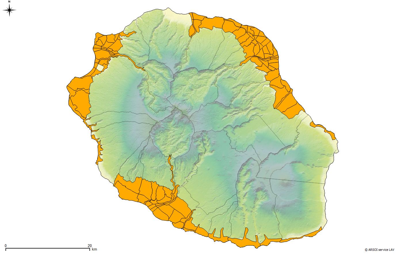
ARS Océan Indien - La Réunion - Zones de contrôle du moustique Anopheles arabiensis vecteur du paludisme
Ce zonage ne couvre que le territoire rural et péri urbain à moins de 500m d'altitude couvrant l'aire de distribution de ce vecteur. Ce zonage est mis périodiquement à jour selon les résultats de la surveillance entomologique.
Simple
- Date (Revision)
- 2014-04-15T08:56:00
- Date (Publication)
- 2014-01-09T08:00:00
- Citation identifier
- https://catalogue.atlasante.fr/geonetwork/srv/0aa2d327-be49-435a-a4cc-e92f2140b2c1
- Point of contact
-
Organisation name Individual name Electronic mail address Role ARS Océan Indien
Originator
- Keywords
-
-
surveillance
-
zonage
-
-
Region
-
-
France
-
-
Domaines
-
-
Zonages des ARS
-
- Use limitation
-
Utilisation libre sous réserve de mentionner la source (a minima le nom du producteur) et la date de sa dernière mise à jour
- Access constraints
- Other restrictions
- Use constraints
- Copyright
- Other constraints
-
Pas de restriction d’accès public selon INSPIRE
- Classification
- Unclassified
- User note
-
accès public total
- Spatial representation type
- Vector
- Denominator
- 5000
- Character set
- UTF8
- Topic category
-
- Health
- Description
-
France
))
- Distribution format
-
Name Version ESRI Shapefile
10
Digital transfer options
- OnLine resource
-
Protocol Linkage Name FILE:GEO
Fichier SIG OGC:WMS-1.1.1-http-get-map
https://carto.atlasante.fr/cgi-bin/mapserv? zonagedesurveillanceentomologi
OGC:WFS-1.0.0-http-get-capabilities
https://carto.atlasante.fr/cgi-bin/mapservwfs? zonagedesurveillanceentomologi
WWW:DOWNLOAD-1.0-http--download
https://telechargement.atlasante.fr/download/0aa2d327-be49-435a-a4cc-e92f2140b2c1 WWW:LINK-1.0-http--link
https://catalogue.atlasante.fr/rss/atomfeed/atomdataset/0aa2d327-be49-435a-a4cc-e92f2140b2c1 Accès au lien ATOM de téléchargement
WWW:DOWNLOAD-1.0-http--download
https://telechargement.atlasante.fr/download/0aa2d327-be49-435a-a4cc-e92f2140b2c1 Accès au téléchargement des données
WWW:LINK-1.0-http--link
https://catalogue.atlasante.fr/geosource/consultationWMS?IDT=558 Accès à la visualisation des données
WWW:DOWNLOAD:application/vnd.geo+json
https://catalogue.atlasante.fr/api/data/0aa2d327-be49-435a-a4cc-e92f2140b2c1?srs=EPSG:4326 API Geojson
- Hierarchy level
- Dataset
- Statement
-
Ce zonage est mis périodiquement à jour selon les résultats de la surveillance entomologique.
- Hierarchy level
- Dataset
Conformance result
- Title
-
Ce zonage est mis périodiquement à jour selon les évolutions observées par les agents de terrain du tissu urbain.
- Date (Publication)
- 2014-04-15
- Explanation
-
Ce zonage est mis périodiquement à jour selon les résultats des la surveillance entomologique.
- Pass
- Feature catalogue citation
Metadata
- File identifier
- 0aa2d327-be49-435a-a4cc-e92f2140b2c1 XML
- Metadata language
- Français
- Character set
- UTF8
- Hierarchy level
- Dataset
- Date stamp
- 2019-07-31T13:34:11
- Metadata standard name
-
ISO 19115:2003/19139
- Metadata standard version
-
1.0
- Metadata author
-
Organisation name Individual name Electronic mail address Role ARS Océan Indien
Author
)))
