Catalogue DataGrandEst
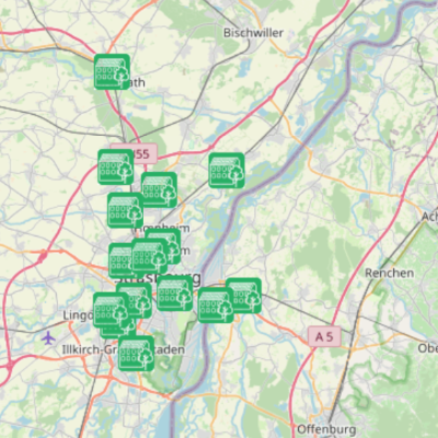
Carte interactive - Adaptations au changement climatique
Interaktive Karte - Anpassungen an den Klimawandel
Interactive map - Adapting to climate change
Dans le cadre du projet Interreg Clim’Ability Care, TRION-climate a recensé et de décrit des exemples de bonnes pratiques en matière d’adaptation au changement climatique dans la région du Rhin supérieur. Ceux-ci sont représentés sur la carte interactive décrite ici.
Im Rahmen des Interreg-Projekts Clim’Ability Care hat TRION-climate e.V. Best-Practice-Beispiele zur Klimaanpassung in der Oberrheinregion erfasst und beschrieben. Diese sind auf der hier beschriebenen interaktiven Karte dargestellt.
As part of the Interreg Clim'Ability Care project, TRION-climat has identified and described examples of good practice in adapting to climate change in the Upper Rhine region. These are shown on the interactive map described here.
Simple
-
Datumsangaben (Publikation)Date (Publication)Date (Publication)
- 2025-03-25T14:23:54
-
PräsentationsformPresentation formForme de la présentation
-
Digitale KarteDigital mapCarte numérique
-
BearbeitungsstatusStatusEtat
-
AbgeschlossenCompletedFinalisé
- Point of contact
-
Organisation name Individual name Electronic mail address Role GeoRhena
BearbeiterProcessorExécutantTRION-climate
VerwalterCustodianGestionnaire
-
ThemaThemeThème
-
-
Mviewer
-
-
GEMET - Concepts, version 2.4
-
-
climat
Klima
climate
-
changement climatique
Klimaänderung
climatic change
-
écologie
Ökologie
ecology
-
bâtiment d'habitation
Wohngebäude
residential building
-
politique de la construction
Baupolitik
construction policy
-
urbanisme
Städtische Gestaltung
urban design
-
-
SpracheLanguageLangue de la ressource
- Français
-
SpracheLanguageLangue de la ressource
- Deutsch
-
SpracheLanguageLangue de la ressource
- English
-
ISO-ThematikTopic categoryCatégorie ISO
-
-
BauwerkeStructureConstructions et ouvrages
-
GesellschaftSocietySociété
-
-
Identifikator des ReferenzsystemsReference system identifierNom du système de référence
-
EPSG:3857
- Distribution format
-
Name Version WMC
WMC
Digitale Transferoptionen
Digital transfer options
Options de transfert numérique
- OnLine resource
-
Protocol Linkage Name WWW:LINK-1.0-http--related https://geoportal.georhena.eu/mviewer/?config=apps/adaptation_changement_climatique_FR.xml Carte interactive en français
Interaktive Karte, auf Französisch
Interactive map in French
WWW:LINK-1.0-http--link
https://geoportal.georhena.eu/mviewer/?config=apps/adaptation_changement_climatique_DE.xml Carte interactive en allemand
Interaktive Karte auf Deutsch
Interactive map in german
Metadata
-
MetadatensatzidentifikatorFile identifierIdentifiant de la fiche
- 1552f553-fcb5-4c6c-b0dd-e9623cabe673 XML
- Metadata language
-
fre
-
ZeichensatzCharacter setJeu de caractères
-
Utf8UTF8Utf8
-
HierarchieebeneHierarchy levelType de ressource
-
interactiveMapinteractiveMapinteractiveMap
- Hierarchy level name
-
Parent
-
DatumDate stampDate des métadonnées
- 2025-04-30T13:28:36.23199Z
- Metadata standard name
-
ISO 19115:2003/19139
- Metadata standard version
-
1.0
- Metadata author
-
Organisation name Individual name Electronic mail address Role GeoRhena
VertriebDistributorDistributeur
- Other language
-
Language Character encoding DeutschGermanAllemandUtf8UTF8Utf8EnglischEnglishAnglaisUtf8UTF8Utf8FranzösischFrenchFrançaisUtf8UTF8Utf8