 Catalogue DataGrandEst
DONNEES : Réseau de contrôle de surveillance (DCE)
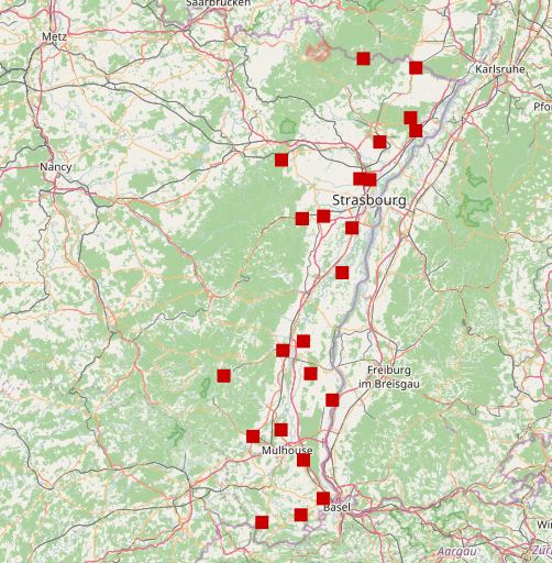
FRCSOP Surveillance de l'état quantitatif des eaux souterraines du bassin Rhin pour le territoire Alsace.
Réseau de surveillance de l'état quantitatif des eaux souterraines mis en place par la Direction de l'Eau du Ministère en charge de l’Environnement pour répondre aux exigences de la Directive Cadre sur l'Eau 2000/60/CE.
Simple
- Date
Citation identifier
No information provided.
Citation identifier
No information provided.
- Point of contact
-
Organisation name Individual name Electronic mail address Role APRONA
TOULET Fabien
Point of contact
- Maintenance and update frequency
- Continual
- Theme
-
-
reseau
-
mesures
-
DCE
-
Alsace
-
- Access constraints
- Other restrictions
- Access constraints
- Other restrictions
- Access constraints
- Other restrictions
- Other constraints
-
Pas de restriction d'accès public
- Classification
- Unclassified
- Spatial representation type
- Vector
- Denominator
- 25000
- Language
- Français
- Character set
- UTF8
- Topic category
-
- Environment
- Description
-
Alsace
N
S
E
W
))
- Reference system identifier
- 2154
Digital transfer options
- OnLine resource
-
Protocol Linkage Name OGC:WMS
http://carto.aprona.net/main/wsgi/mapserv_proxy? reseau_rcs_quantite
- Hierarchy level
- Dataset
- Date
Metadata
- File identifier
- 168e094b-a661-4a77-a3b9-32313a149a8f XML
- Metadata language
- Français
- Character set
- UTF8
- Hierarchy level
- Dataset
- Date stamp
- 2017-03-01
- Metadata standard name
-
ISO 19115/19139
- Metadata standard version
-
Cor 1:2006
- Metadata author
-
Organisation name Individual name Electronic mail address Role APRONA
TOULET Fabien
Point of contact APRONA
TOULET Fabien
Author
)))