Catalogue DataGrandEst
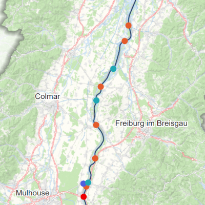
Upper Rhine border crossings
Map showing border crossing points and specifying the type of crossing (road, motorway, cycle/pedestrian or rail) in the Upper Rhine area.
Simple
- Date (Creation)
- 2024-11-04
- Date (Publication)
- 2024-11-15
- Date (Revision)
- 2025-02-05
- Citation identifier
- 19_2024_346
- Status
- Completed
- Point of contact
-
Organisation name Individual name Electronic mail address Role GeoRhena
GeoRhena
Processor
- Maintenance and update frequency
- Not planned
- Keywords
-
-
Map
-
- Keywords
-
-
Upper Rhine
-
- Use limitation
-
Licence CC BY
- Access constraints
- Other restrictions
- Use constraints
- Other restrictions
- Other constraints
-
No other limitation
- Denominator
- 700000
- Language
- Français
- Character set
- UTF8
- Topic category
-
- Transportation
- Structure
- Begin date
- 2024-01-01
- End date
- 2024-12-31
- Distribution format
-
Name Version PDF Map
-
Digital transfer options
- OnLine resource
-
Protocol Linkage Name WWW:DOWNLOAD-1.0-http--download https://www.georhena.eu/sites/default/files/Cartes/19_2024_346.pdf Upper Rhine border crossings
Metadata
- File identifier
- 1aa0e68a-d34b-4850-a557-fbad626fa348 XML
- Metadata language
- Français
- Character set
- UTF8
- Hierarchy level
- staticMap
- Hierarchy level name
-
Carte statique
- Date stamp
- 2025-10-06T07:30:19.426553Z
- Metadata standard name
-
ISO 19115:2003/19139
- Metadata standard version
-
1.0
- Metadata author
-
Organisation name Individual name Electronic mail address Role GeoRhena: Geographical Information System of the Upper Rhine
Author
- Other language
-
Language Character encoding German UTF8 English UTF8 French UTF8