 Catalogue DataGrandEst
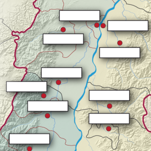
Carte jeu: Replacez les villes du Rhin Supérieur !
Kartenspiel: Platzieren Sie die Städte am Oberrhein!
Game map: Place the cities of the Upper Rhine!
Cette carte prend la forme d'un jeu. Il s'agit de retrouver le nom des villes manquantes sur le document. Bonne chance !!
Diese Karte ist ein Spiel. Es geht darum, die Namen der fehlenden Städte auf dem Dokument zu finden. Viel Glück!
This map is a game. You have to find the names of the missing cities on the document. Good luck!
Simple
-
Datumsangaben (Erstellung)Date (Creation)Date (Création)
- 2013-01-01
-
Datumsangaben (Publikation)Date (Publication)Date (Publication)
- 2022-06-20
-
IdentifikatorCitation identifierIdentificateur
- 01_2013_0182
-
BearbeitungsstatusStatusEtat
-
AbgeschlossenCompletedFinalisé
- Point of contact
-
Organisation name Individual name Electronic mail address Role GeoRhena
GeoRhena
GeoRhena
GeoRhena
BearbeiterProcessorExécutant
-
ÜberarbeitungsintervallMaintenance and update frequencyFréquence de mise à jour
-
Nicht geplantNot plannedNon planifiée
- Keywords
-
-
Carte
Karte
Map
-
- Keywords
-
-
Rhin Supérieur
Oberrhein
Upper Rhine
-
Jeu
Spiel
Game
-
-
GEMET - Concepts, version 2.4
-
-
coopération
Zusammenarbeit
co-operation
-
jeu
Spiel
game (play)
-
géographie
Geographie
geography
-
-
Limitation d'utilisationAnwendungseinschränkungenUse limitation
-
Licence CC BY
Licence CC BY
Licence CC BY
-
ZugriffseinschränkungenAccess constraintsContraintes d'accès
-
Benutzerdefinierte EinschränkungenOther restrictionsAutres restrictions
-
NutzungseinschränkungenUse constraintsContraintes d'utilisation
-
Benutzerdefinierte EinschränkungenOther restrictionsAutres restrictions
-
Autres contraintesAndere EinschränkungenOther constraints
-
Pas d'autre limitation
Keine andere Einschränkung
No other limitation
-
MaßstabszahlDenominatorDénominateur de l'échelle
- 100000
-
SpracheLanguageLangue de la ressource
- Français
-
ZeichensatzCharacter setEncodage des caractères
-
Utf8UTF8Utf8
-
ISO-ThematikTopic categoryCatégorie ISO
-
-
OberflächenbeschreibungImagery base maps earth coverCarte de référence de la couverture terrestre
-
- Begin date
- 2013-01-01
- End date
- 2013-12-31
))
- Distribution format
-
Name Version Carte au format PDF
Karte in PDF
PDF Map
-
Digitale Transferoptionen
Digital transfer options
Options de transfert numérique
- OnLine resource
-
Protocol Linkage Name WWW:DOWNLOAD-1.0-http--download
https://www.georhena.eu/sites/default/files/Cartes/01_2013_182.pdf Téléchargement du Pdf
Pdf herunterladen
Pdf Download
Metadata
-
MetadatensatzidentifikatorFile identifierIdentifiant de la fiche
- 22c317fb-fe63-4e8e-aad1-f5c161906fd0 XML
-
SpracheMetadata languageLangue
- Français
-
ZeichensatzCharacter setJeu de caractères
-
Utf8UTF8Utf8
-
HierarchieebeneHierarchy levelType de ressource
-
staticMapstaticMapstaticMap
- Hierarchy level name
-
Carte statique
-
DatumDate stampDate des métadonnées
- 2024-10-10T09:21:20.563723Z
- Metadata standard name
-
ISO 19115:2003/19139
- Metadata standard version
-
1.0
- Metadata author
-
Organisation name Individual name Electronic mail address Role GeoRhena: Système d'Information Géographique du Rhin Supérieur
GeoRhena: Geographische Informationssystem des Oberrheins
GeoRhena: Geographical Information System of the Upper Rhine
AutorAuthorAuteur
- Other language
-
Language Character encoding DeutschGermanAllemandUtf8UTF8Utf8EnglischEnglishAnglaisUtf8UTF8Utf8FranzösischFrenchFrançaisUtf8UTF8Utf8
)))
