DONNEES : Carte piézométrique BE - 09/09/1991
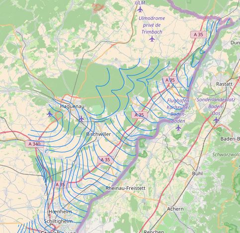
Carte piézométrique (09/09/1991) en situation de basses eaux (BE).
La première cartographie piézométrique de l’ensemble de la nappe d’Alsace, largement diffusée et utilisée, a été réalisée et éditée en 1995 par la Région Alsace, pour une situation de basses eaux du 09/09/1991, dans le cadre du Projet transfrontalier INTERREG « Cartographie Hydrogéologique du Rhin Supérieur », projet cofinancé par l’Agence de l’eau Rhin-Meuse, le Ministère de l’environnement et l’Umwelt Ministerium Baden-Württemberg.
Simple
- Date (Creation)
- 1991-09-09
Citation identifier
Citation identifier
Point of contact
- Maintenance and update frequency
- Not planned
- Theme
-
-
piézométrie
-
nappe
-
rhénane
-
BE
-
Resource constraints
Resource constraints
- Spatial representation type
- Vector
- Denominator
- 50000
- Topic category
-
- Environment
- Description
-
Alsace
))
- Reference system identifier
- 2154
Digital transfer options
- OnLine resource
-
Protocol Linkage Name https://www.datagrandest.fr/metadata/aprona/pdf/cartes_piezometriques_INTERREG_notice.pdf Notice technique de la carte piézométrique
OGC:WMS
http://carto.aprona.net/main/wsgi/mapserv_proxy? piezo_carte_be_201109_v3
- Date
Metadata
- File identifier
- 2a771bb2-ca9a-4dcc-990c-6d65f04e444e XML
- Date stamp
- 2017-03-01
- Metadata author
-
Organisation name Individual name Electronic mail address Role APRONA
Owner APRONA
TOULET Fabien
Point of contact
Overviews
Spatial extent
)))
Provided by
