Catalogue DataGrandEst
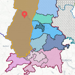
Political leaders of the main administrative territories of the Upper Rhine
Interactive map showing the different political leaders of the Upper Rhine.
Simple
- Date (Creation)
- 2022-10-01
- Date (Publication)
- 2022-10-24T08:33:49
- Date (Revision)
- 2026-01-21
- Presentation form
- Digital map
- Status
- Completed
- Point of contact
-
Organisation name Individual name Electronic mail address Role GeoRhena
Author
- Keywords
-
-
Mviewer
-
elected members
-
- Language
- Français
- Reference system identifier
- EPSG:3857
- Distribution format
-
Name Version OGC:OWS-C
Digital transfer options
- OnLine resource
-
Protocol Linkage Name WWW:LINK-1.0-http--related
https://geoportal.georhena.eu/mviewer/?config=apps/elus_crs.xml The political leaders of the main administrative territories of the Upper Rhine
Metadata
- File identifier
- 2fc47f5b-feac-411f-b1d5-89d4e0c6de3f XML
- Metadata language
-
fre
- Character set
- UTF8
- Hierarchy level
- interactiveMap
- Hierarchy level name
-
1.0
- Date stamp
- 2026-01-26T15:23:24.556851Z
- Metadata standard name
-
ISO 19115:2003/19139
- Metadata standard version
-
1.0
- Metadata author
-
Organisation name Individual name Electronic mail address Role GeoRhena
Author
- Other language
-
Language Character encoding German UTF8 English UTF8 French UTF8