Catalogue DataGrandEst
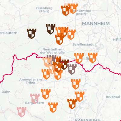
Interactive map - Inventory of Rhine castles
Interactive map based on data from the archaeological inventory of Upper Rhine castles, dedicated to an exhibition.
Simple
- Date (Publication)
- 2024-11-07T14:23:54
- Presentation form
- Digital map
- Status
- Completed
- Point of contact
-
Organisation name Individual name Electronic mail address Role GeoRhena
Point of contact
- Theme
-
-
Mviewer
-
- Language
- Français
- Language
- Deutsch
- Topic category
-
- Structure
- Society
- Reference system identifier
- EPSG:3857
- Distribution format
-
Name Version WMC
WMC
Digital transfer options
- OnLine resource
-
Protocol Linkage Name WWW:LINK-1.0-http--related https://geoportal.georhena.eu/mviewer/?config=apps/expo_burgen_oberrhein.xml# Interactive map dedicated to an exhibition on the Upper Rhine castles in German
WWW:LINK-1.0-http--link
https://geoportal.georhena.eu/mviewer/?config=apps/expo_chateaux_rhenans.xml# Interactive map dedicated to an exhibition on the Upper Rhine castles in French
Metadata
- File identifier
- 37d4d57d-cf62-4b91-9558-59ec1c04bf47 XML
- Metadata language
-
fre
- Character set
- UTF8
- Hierarchy level
- interactiveMap
- Hierarchy level name
-
Parent
- Date stamp
- 2025-10-06T07:11:51.386014Z
- Metadata standard name
-
ISO 19115:2003/19139
- Metadata standard version
-
1.0
- Metadata author
-
Organisation name Individual name Electronic mail address Role GeoRhena
Distributor
- Other language
-
Language Character encoding German UTF8 English UTF8 French UTF8