 Catalogue DataGrandEst
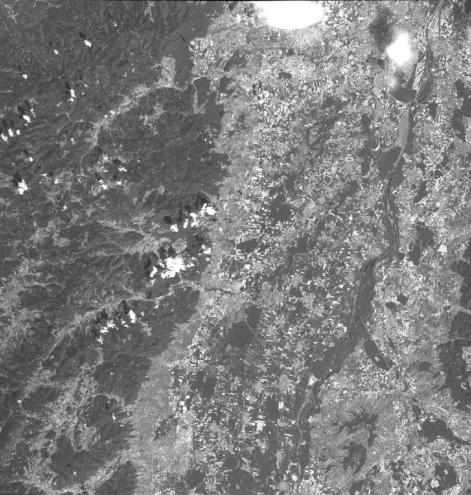
SPOT 6 PAN L1A 2020-07-27 10:12:30Z
L1A PAN image acquired by SPOT 6 on 2020-07-27 at 10:12:30Z
Simple
- Date (Creation)
- 2020-10-28T12:21:43Z
- Date (Publication)
- 2020-10-28T12:21:43Z
- Date (Revision)
- 2020-10-28T12:21:43Z
- Keywords
-
-
Dotcloud identifier: 1030393667320819
-
SRD GEOSUD / IRD
-
Irstea
-
IGN
-
End time: 2020-07-27T10:12:30Z
-
Resolution: 2.28 m
-
Alsace
-
Baden-Württemberg
-
Moselle
-
Lorraine
-
PMS
-
KALCNES
-
Germany
-
Meurhe-et-Moselle
-
PAN
-
Bas-Rhin
-
L1A
-
France
-
SPOT 6
-
Vosges
-
Europe
-
Haute-Rhin
-
SPOT6
-
SPOT6_P_SENSOR_20200727_101230
-
eo_image
-
optical
-
Incidence angle: -11.0360 deg.
-
N
S
E
W
))
Digital transfer options
- OnLine resource
-
Protocol Linkage Name WWW:LINK-1.0-http--related
https://www.kalideos.fr/drupal/features/39b2689a-df8f-5c14-be8e-cf5d0ed710a1 Description page
WWW:LINK-1.0-http--image-quicklook
https://www.kalideos.fr/map/products/20200727/1030393667320819/ql_1030393667320819.jpg Quicklook
WWW:LINK-1.0-http--image-thumbnail
https://www.kalideos.fr/map/products/20200727/1030393667320819/thumb_1030393667320819.jpg Thumbnail
WWW:LINK-1.0-http--license
https://www.kalideos.fr/map/products/Licenses/GEOSUD_SPOT67_2016_fr.pdf License
WWW:LINK-1.0-http--annexe
https://www.kalideos.fr/map/products/20200727/1030393667320819/annexes_SPOT6_P_SENSOR_20200727_101230/INDEX.HTM Annexe
Metadata
- File identifier
- 39b2689a-df8f-5c14-be8e-cf5d0ed710a1 XML
- Metadata language
-
en
- Hierarchy level
- Dataset
- Date stamp
- 2020-10-28T12:21:43Z
- Metadata standard name
-
ISO19115
- Metadata standard version
-
2003/Cor.1:2006
- Metadata author
-
Organisation name Individual name Electronic mail address Role Point of contact
)))
