 Catalogue DataGrandEst
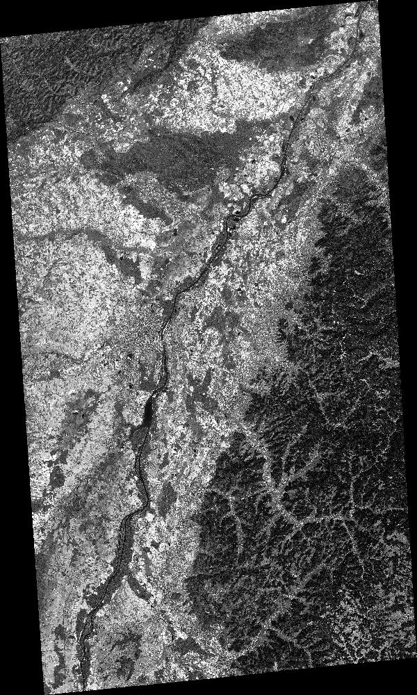
SPOT 7 PAN ORTHO_TOC 2017-04-07 09:57:40Z
ORTHO_TOC PAN image acquired by SPOT 7 on 2017-04-07 at 09:57:40Z
Simple
- Date (Creation)
- 2020-05-18T20:45:53Z
- Date (Publication)
- 2020-05-18T20:45:53Z
- Date (Revision)
- 2020-05-18T20:45:53Z
- Keywords
-
-
Dotcloud identifier: 2967779946452778
-
Kalideos
-
End time: 2017-04-07T09:57:40Z
-
Resolution: 1.25 m
-
PAN
-
Alsace
-
Rheinland-Pfalz
-
Baden-Württemberg
-
Moselle
-
Lorraine
-
SPOT 7
-
KALCNES
-
Germany
-
Bas-Rhin
-
ORTHO_TOC
-
France
-
Europe
-
NAOMI7
-
Haute-Rhin
-
SPOT7_NAOMI7_P_ORTHO_TOC_20170407_095740
-
eo_image
-
optical
-
Incidence angle: 16.7811 deg.
-
N
S
E
W
))
Digital transfer options
- OnLine resource
-
Protocol Linkage Name WWW:LINK-1.0-http--related
https://www.kalideos.fr/drupal/features/68a0fca2-6031-5413-aa86-2a34b626e2f0 Description page
WWW:LINK-1.0-http--image-quicklook
https://www.kalideos.fr/map/products/20170407/2967779946452778/ql_2967779946452778.jpg Quicklook
WWW:LINK-1.0-http--image-thumbnail
https://www.kalideos.fr/map/products/20170407/2967779946452778/thumb_2967779946452778.jpg Thumbnail
WWW:LINK-1.0-http--license
https://www.kalideos.fr/map/products/Licenses/GEOSUD_SPOT67_2016_fr.pdf License
WWW:LINK-1.0-http--annexe
https://www.kalideos.fr/map/products/20170407/2967779946452778/annexes_SPOT7_NAOMI7_P_ORTHO_TOC_20170407_095740/index.html Annexe
Metadata
- File identifier
- 68a0fca2-6031-5413-aa86-2a34b626e2f0 XML
- Metadata language
-
en
- Hierarchy level
- Dataset
- Date stamp
- 2020-05-18T20:45:53Z
- Metadata standard name
-
ISO19115
- Metadata standard version
-
2003/Cor.1:2006
- Metadata author
-
Organisation name Individual name Electronic mail address Role Point of contact
)))
