 Catalogue DataGrandEst
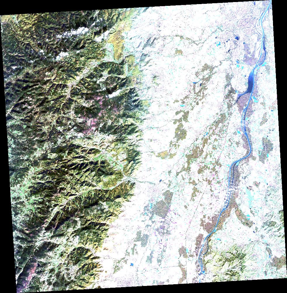
SPOT 6 XS ORTHO_TOC 2017-10-31 10:06:57Z
ORTHO_TOC XS image acquired by SPOT 6 on 2017-10-31 at 10:06:57Z
Simple
- Date (Creation)
- 2020-05-18T20:29:43Z
- Date (Publication)
- 2020-05-18T20:29:43Z
- Date (Revision)
- 2020-05-18T20:29:43Z
- Keywords
-
-
Dotcloud identifier: 2966908265383267
-
Kalideos
-
End time: 2017-10-31T10:06:57Z
-
Resolution: 5.00 m
-
Alsace
-
Baden-Württemberg
-
Moselle
-
Lorraine
-
KALCNES
-
Germany
-
Meurhe-et-Moselle
-
Bas-Rhin
-
XS
-
NAOMI6
-
France
-
SPOT 6
-
Vosges
-
Europe
-
ORTHO_TOC
-
Haute-Rhin
-
SPOT6_NAOMI6_MS_ORTHO_TOC_20171031_100657
-
eo_image
-
optical
-
Incidence angle: 3.9971 deg.
-
N
S
E
W
))
Digital transfer options
- OnLine resource
-
Protocol Linkage Name WWW:LINK-1.0-http--related
https://www.kalideos.fr/drupal/features/839d1596-ed62-5816-8e64-c9078e65e0f0 Description page
WWW:LINK-1.0-http--image-quicklook
https://www.kalideos.fr/map/products/20171031/2966908265383267/ql_2966908265383267.jpg Quicklook
WWW:LINK-1.0-http--image-thumbnail
https://www.kalideos.fr/map/products/20171031/2966908265383267/thumb_2966908265383267.jpg Thumbnail
WWW:LINK-1.0-http--license
https://www.kalideos.fr/map/products/Licenses/GEOSUD_SPOT67_2016_fr.pdf License
WWW:LINK-1.0-http--annexe
https://www.kalideos.fr/map/products/20171031/2966908265383267/annexes_SPOT6_NAOMI6_MS_ORTHO_TOC_20171031_100657/index.html Annexe
Metadata
- File identifier
- 839d1596-ed62-5816-8e64-c9078e65e0f0 XML
- Metadata language
-
en
- Hierarchy level
- Dataset
- Date stamp
- 2020-05-18T20:29:43Z
- Metadata standard name
-
ISO19115
- Metadata standard version
-
2003/Cor.1:2006
- Metadata author
-
Organisation name Individual name Electronic mail address Role Point of contact
)))
