 Catalogue DataGrandEst
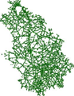
ROUTES : Référentiel routier - Bornage [HAUTE-MARNE 2026]
DONNEES - Bornage des routes départementales, nationales et autoroutes de Haute-Marne (52).
Les Points de Repère (PR) sur le réseau routier de Haute-Marne sont également nommés Points de Localisation (PLos). Ils sont composés des bornes et débuts de voies et baïonnettes. Les éléments descriptifs des PR sont : le code de la voie, le code du PR, les distances interPR précédente et suivante.
Simple
- Date (Creation)
- 2024-06-29
- Date (Publication)
- Citation identifier
- FR-225200013-GRAPHE_PLO52
- Edition
-
Version des données : 2024-A
- Edition date
- 2024-06-22
- Other citation details
-
Dernière mise à jour : juin 2024 - Périodicité de mise à jour : Annuelle
- Date (Revision)
- 2026-03-10T00:00:00
- Point of contact
-
Organisation name Individual name Electronic mail address Role Conseil départemental de la Haute-Marne - Service SIG
Point of contact Conseil départemental de la Haute-Marne - Service Exploitation et Sécurité Routière
Principal investigator
- Maintenance and update frequency
- Annually
- Use limitation
-
Licence etalab / Licence ouverte / open licence version 2.0 (Avril 2017) https://www.etalab.gouv.fr/wp-content/uploads/2017/04/ETALAB-Licence-Ouverte-v2.0.pdf
Resource constraints
- Access constraints
- Other restrictions
- Classification
- Unclassified
Resource constraints
- Classification
- Unclassified
- Use limitation
-
Données sous licence Etalab v2 (cf. https://www.etalab.gouv.fr/wp-content/uploads/2017/04/ETALAB-Licence-Ouverte-v2.0.pdf)
- Use limitation
-
Sources: ...
- Use constraints
- License
- Access constraints
- Other restrictions
- Other constraints
-
Pas de restriction d'accès public
- Spatial representation type
- Vector
- Language
- Français
- Character set
- UTF8
- Topic category
-
- Transportation
- Description
-
Haute-Marne
))
- Geographic identifier
- https://www.datagandest.fr/thesaurus/departement#52
- Credit
-
CD52
- Theme
-
-
routes
-
réseaux routiers
-
voierie
-
données ouvertes
-
Géoportail
-
bornage
-
Réseaux de transport
-
-
DataGrandEst - Thèmes open data, version 1.0 (dge-tod)
-
-
MOBILITE ET TRANSPORTS
-
-
Départements
-
-
Haute-Marne
-
- Reference system identifier
- RGF93 – Lambert 93 (EPSG:2154)
Digital transfer options
- OnLine resource
-
Protocol Linkage Name WWW:LINK
https://sig.haute-marne.fr/arcopolepro/opendata/FR-225200013-GRAPHE_PLO52-ATTRIBUTS.csv FR-225200013-GRAPHE_PLO52-ATTRIBUTS.csv
Digital transfer options
- OnLine resource
-
Protocol Linkage Name WWW:LINK
https://sig.haute-marne.fr/arcopolepro/opendata/FR-225200013-GRAPHE_PLO52-DONNEES.csv FR-225200013-GRAPHE_PLO52-DONNEES.csv
Digital transfer options
- OnLine resource
-
Protocol Linkage Name WWW:DOWNLOAD
https://sig.haute-marne.fr/arcopolepro/opendata/FR-225200013-GRAPHE_PLO52-SHP.zip FR-225200013-GRAPHE_PLO52-SHP.zip
Digital transfer options
- OnLine resource
-
Protocol Linkage Name WWW:DOWNLOAD
https://sig.haute-marne.fr/arcopolepro/opendata/FR-225200013-GRAPHE_PLO52-KML.zip FR-225200013-GRAPHE_PLO52-KML.zip
Digital transfer options
- OnLine resource
-
Protocol Linkage Name WWW:DOWNLOAD
https://sig.haute-marne.fr/arcopolepro/opendata/FR-225200013-GRAPHE_PLO52-GEOJSON.zip FR-225200013-GRAPHE_PLO52-GEOJSON.zip
Digital transfer options
- OnLine resource
-
Protocol Linkage Name WWW:DOWNLOAD
https://sig.haute-marne.fr/arcopolepro/opendata/FR-225200013-GRAPHE_PLO52-DONNEES.zip FR-225200013-GRAPHE_PLO52-DONNEES.zip
Digital transfer options
- OnLine resource
-
Protocol Linkage Name WWW:DOWNLOAD
https://sig.haute-marne.fr/arcopolepro/opendata/FR-225200013-GRAPHE_PLO52-ATTRIBUTS.csv FR-225200013-GRAPHE_PLO52-ATTRIBUTS.csv
Digital transfer options
- OnLine resource
-
Protocol Linkage Name OGC:WFS
https://sig.haute-marne.fr/arcgis/services/Portal/FR_225200013_SP2/MapServer/WFSServer?request=GetCapabilities%26service=WFS Portal_FR_225200013_SP2:CD52_RRD_Bornage
Digital transfer options
- OnLine resource
-
Protocol Linkage Name OGC:WMS
https://sig.haute-marne.fr/arcgis/services/Portal/FR_225200013_SP2/MapServer/WMSServer?request=GetCapabilities%26service=WMS 15
- Hierarchy level
- Dataset
- Date
- Statement
-
2012-2018 : géolocalisation de l'ensemble des bornes du RRD
Depuis 2018 : mise à jour annuelle
Metadata
- File identifier
- FR-225200013-GRAPHE_PLO52 XML
- Metadata language
- Français
- Character set
- UTF8
- Hierarchy level
- Dataset
- Date stamp
- 2026-04-01T13:26:40.548003Z
- Metadata standard name
-
ISO 19115/19139
- Metadata standard version
-
2003/Cor.1:2006
- Metadata author
-
Organisation name Individual name Electronic mail address Role Conseil départemental de la Haute-Marne - Service SIG
Point of contact
)))