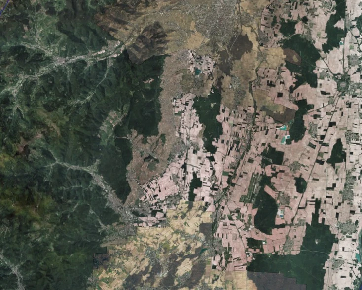
DONNEES - OrthoPhotographies d'Alsace - ortho composite
Le fond photographique d'Alsace est un composé d'orthophotographies réalisées par plusieurs producteurs:
- l'orthophotographie CIGAL sur toute l'Alsace + Kiehl (2011-12)
- l'orthophotographie réalisé sur la Communauté d'agglomération de Colmar (résolution 10 cm) en 2014
- l'orthophotographie réalisé sur Mulhouse Alsace Agglomération (résolution 10 cm) en 2014
- l'orthophotographie réalisé sur la Communauté Urbaine de Strasbourg (résolution 8 cm) en 2013
- la photographie satellite d'habillage pour les petites échelles (PlanetSat 15m puis True Marble pour le compte de la Région Alsace, 2013)
Simple
- Date (Publication)
- 2014-11-28
- Citation identifier
- MD_URI / FR-236700019-CIGAL_RASTER_COMPOSITE
- Citation identifier
- / FR-236700019-CIGAL_RASTER_COMPOSITE
- Point of contact
-
Organisation name Individual name Electronic mail address Role CIGAL
Point of contact CIGAL
Custodian
- Maintenance and update frequency
- Continual
- Place
-
-
Alsace
-
- Theme
-
-
raster
-
-
external._none_.gemet
-
-
photographie aérienne
-
-
local
-
-
Référentiel
-
-
GEMET - INSPIRE themes, version 1.0
-
-
Ortho-imagerie
-
- Use limitation
-
Etre membre du réseau CIGAL (signature de l'acte d'adhésion annexé à la Convention cadre - Annexe 2)
- Access constraints
- Intellectual property rights
- Access constraints
- Other restrictions
- Other constraints
-
Pas de restriction d'accès public
- Classification
- Unclassified
- Spatial representation type
- Grid
- Denominator
- 0
- Language
- Français
- Character set
- UTF8
- Topic category
-
- Imagery base maps earth cover
- Description
-
Alsace
))
- Reference system identifier
- Google Mercator (EPSG:3857)
- Distribution format
-
Name Version TIFF
6.0
Digital transfer options
- OnLine resource
- Hierarchy level
- Series
Metadata
- File identifier
- FR-236700019-CIGAL_RASTER_COMPOSITE XML
- Metadata language
- Français
- Character set
- UTF8
- Hierarchy level
- Series
- Date stamp
- 2014-11-28
- Metadata standard name
-
ISO 19115
- Metadata standard version
-
1.0
- Metadata author
-
Organisation name Individual name Electronic mail address Role CIGAL
Point of contact
Overviews
Spatial extent
)))
Provided by
