 Catalogue DataGrandEst
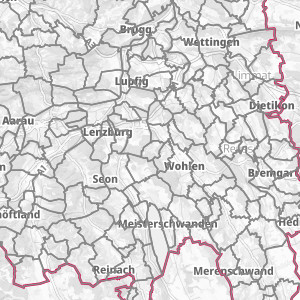
Upper Rhine Administrative base - 2024
Upper Rhine Administrative base - Update 2024
Simple
- Alternate title
-
Administrative base 2024
- Date (Creation)
- 2022-02-18
- Date (Publication)
- 2022-02-18
- Date (Revision)
- 2024-02-28
- Citation identifier
- limites_communales
- Status
- Completed
- Point of contact
-
Organisation name Individual name Electronic mail address Role GeoRhena
GeoRhena
Point of contact
- Maintenance and update frequency
- Annually
- Keywords
-
-
Open-Data
-
- Place
-
-
Upper Rhine
-
-
GEMET - INSPIRE themes, version 1.0
-
-
Statistical units
-
Administrative units
-
Geographical names
-
-
GEMET - Concepts, version 2.4
-
-
municipality
-
urban community
-
administrative boundary
-
- Use limitation
-
© + OSM contributors + Add GeoRhena logo in case of reuse
- Access constraints
- Other restrictions
- Use constraints
- Other restrictions
- Other constraints
-
No other limitation
- Spatial representation type
- Vector
- Denominator
- 100000
- Language
- Français
- Language
- Deutsch
- Language
- English
- Character set
- UTF8
- Begin date
- 2024-01-01
- End date
- 2024-12-31
N
S
E
W
))
- Distribution format
-
Name Version SHP GeoData
-
Digital transfer options
- OnLine resource
-
Protocol Linkage Name OGC:WMS
https://geoportal.georhena.eu/geoserver/boundaries/ows limites_communales
OGC:WFS
https://geoportal.georhena.eu/geoserver/boundaries/ows boundaries:limites_communales
WWW:DOWNLOAD-1.0-ftp--download
https://geoportal.georhena.eu/geoserver/boundaries/ows?request=GetFeature&service=WFS&typeName=limites_communales&version=1.0.0&outputFormat=SHAPE-ZIP Téléchargement du Shapefile Téléchargement du Shapefile
- Hierarchy level
- Dataset
- Statement
-
GeoRhena + OSM contributors - 2021
Metadata
- File identifier
- acf56ec7-2719-46fb-bac6-725c47e6bfb1 XML
- Metadata language
- Français
- Character set
- UTF8
- Hierarchy level
- Dataset
- Date stamp
- 2024-04-03T12:19:25.525845Z
- Metadata standard name
-
ISO 19115:2003/19139
- Metadata standard version
-
1.0
- Metadata author
-
Organisation name Individual name Electronic mail address Role GeoRhena: Geographical Information System of the Upper Rhine
Point of contact
- Other language
-
Language Character encoding German UTF8 English UTF8 French UTF8
)))
