 Catalogue DataGrandEst
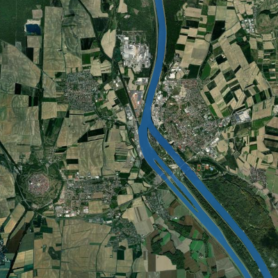
Border of the river Rhine
Border for the river Rhine in the area of the Upper Rhine according to the data of the european project COPERNICUS. Do not use for navigation !
Simple
- Date (Creation)
- 2023-06-21
- Date (Publication)
- 2023-10-01
- Citation identifier
- emprise_rhin
- Status
- Completed
- Point of contact
-
Organisation name Individual name Electronic mail address Role GeoRhena
GeoRhena
Point of contact COPERNICUS
Owner
- Maintenance and update frequency
- As needed
- Keywords
-
-
Upper Rhine
-
river
-
border
-
-
GEMET - Concepts, version 2.4
-
-
river channelling
-
river
-
- Use limitation
-
CC BY Licence
- Access constraints
- Other restrictions
- Use constraints
- Other restrictions
- Spatial representation type
- Vector
- Denominator
- 100000
- Language
- Français
- Character set
- UTF8
- Topic category
-
- Inland waters
- Begin date
- 2006-01-01
- End date
- 2012-12-31
))
- Distribution format
-
Name Version Geodata as vector data
-
Digital transfer options
- OnLine resource
-
Protocol Linkage Name OGC:WMS
https://geoportal.georhena.eu/geoserver/environment/ows emprise_rhin
OGC:WFS
https://geoportal.georhena.eu/geoserver/environment/ows environment:emprise_rhin
WWW:DOWNLOAD-1.0-ftp--download
https://geoportal.georhena.eu/geoserver/environment/ows?request=GetFeature&service=WFS&typeName=emprise_rhin&version=1.0.0&outputFormat=SHAPE-ZIP Download of Vector Data
WWW:LINK-1.0-http--link
www.copernicus.eu Dedicated website of the COPERNICUS project
- Hierarchy level
- Dataset
- Statement
-
All informations about the data creation can be found here:
https://land.copernicus.eu/imagery-in-situ/eu-hydro/eu-hydro-river-network-database?tab=metadata
Metadata
- File identifier
- bab0bcef-0f70-480c-ba4a-1e7613ef0280 XML
- Metadata language
- Français
- Character set
- UTF8
- Hierarchy level
- Dataset
- Date stamp
- 2025-06-18T15:11:37.682115Z
- Metadata standard name
-
ISO 19115:2003/19139
- Metadata standard version
-
1.0
- Metadata author
-
Organisation name Individual name Electronic mail address Role GeoRhena: Geographical Information System of the Upper Rhine
Point of contact
- Other language
-
Language Character encoding German UTF8 English UTF8 French UTF8
)))
