 Catalogue DataGrandEst
Responsables politiques des principaux territoires administratifs du Rhin Supérieur (Janvier 2026)
Verantwortliche den wichtigsten Institutionen und Gebietskörperschaften am Oberrhein (Januar 2026)
Political leaders of the main administrative territories of the Upper Rhine (January 2026)
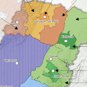
Cette carte propose de découvrir, sous la forme d'un trombinoscope, les différents responsables politiques des principaux territoires administratifs du Rhin Supérieur.
Diese Karte bietet die Möglichkeit, in Form eines Pinnwandeintrags die verschiedenen politischen Verantwortlichen der wichtigsten Verwaltungsgebiete am Oberrhein zu entdecken.
This map proposes to discover, in the form of a trombinoscope, the different political leaders of the main administrative territories of the Upper Rhine.
Simple
-
Datumsangaben (Erstellung)Date (Creation)Date (Création)
- 2022-10-01
-
Datumsangaben (Publikation)Date (Publication)Date (Publication)
- 2022-10-24
-
Datumsangaben (Überarbeitung)Date (Revision)Date (Révision)
- 2026-01-21
-
IdentifikatorCitation identifierIdentificateur
- 10_2022_288
-
BearbeitungsstatusStatusEtat
-
AbgeschlossenCompletedFinalisé
- Point of contact
-
Organisation name Individual name Electronic mail address Role GeoRhena
GeoRhena
GeoRhena
GeoRhena
BearbeiterProcessorExécutant
-
ÜberarbeitungsintervallMaintenance and update frequencyFréquence de mise à jour
-
Nicht geplantNot plannedNon planifiée
- Keywords
-
-
élus
Volksvertrer
elected members
-
- Keywords
-
-
Carte
Karte
Map
-
- Keywords
-
-
Rhin Supérieur
Oberrhein
Upper Rhine
-
-
Limitation d'utilisationAnwendungseinschränkungenUse limitation
-
Licence CC BY
Licence CC BY
Licence CC BY
-
ZugriffseinschränkungenAccess constraintsContraintes d'accès
-
Benutzerdefinierte EinschränkungenOther restrictionsAutres restrictions
-
NutzungseinschränkungenUse constraintsContraintes d'utilisation
-
Benutzerdefinierte EinschränkungenOther restrictionsAutres restrictions
-
Autres contraintesAndere EinschränkungenOther constraints
-
Pas d'autre limitation
Keine andere Einschränkung
No other limitation
-
MaßstabszahlDenominatorDénominateur de l'échelle
- 100000
-
SpracheLanguageLangue de la ressource
- Français
-
ZeichensatzCharacter setEncodage des caractères
-
Utf8UTF8Utf8
-
ISO-ThematikTopic categoryCatégorie ISO
-
-
GrenzenBoundariesLimites politiques et administratives
-
- Begin date
- 2025-08-01
- End date
- 2025-12-31
- Distribution format
-
Name Version Carte au format PDF
Karte in PDF
PDF Map
-
Digitale Transferoptionen
Digital transfer options
Options de transfert numérique
- OnLine resource
-
Protocol Linkage Name WWW:DOWNLOAD-1.0-http--download
https://www.georhena.eu/sites/default/files/Cartes/10_2022_288.pdf Téléchargement du Pdf
Pdf herunterladen
Pdf Download
Metadata
-
MetadatensatzidentifikatorFile identifierIdentifiant de la fiche
- d7efd678-bc57-4648-a67f-6e02386abeb9 XML
-
SpracheMetadata languageLangue
- Français
-
ZeichensatzCharacter setJeu de caractères
-
Utf8UTF8Utf8
- Parent identifier
-
Responsables politiques des principaux territoires administratifs du Rhin Supérieur
2fc47f5b-feac-411f-b1d5-89d4e0c6de3f
-
HierarchieebeneHierarchy levelType de ressource
-
staticMapstaticMapstaticMap
- Hierarchy level name
-
Carte statique
-
DatumDate stampDate des métadonnées
- 2026-01-21T08:19:02.174187Z
- Metadata standard name
-
ISO 19115:2003/19139
- Metadata standard version
-
1.0
- Metadata author
-
Organisation name Individual name Electronic mail address Role GeoRhena: Système d'Information Géographique du Rhin Supérieur
GeoRhena: Geographische Informationssystem des Oberrheins
GeoRhena: Geographical Information System of the Upper Rhine
AutorAuthorAuteur
- Other language
-
Language Character encoding DeutschGermanAllemandUtf8UTF8Utf8EnglischEnglishAnglaisUtf8UTF8Utf8FranzösischFrenchFrançaisUtf8UTF8Utf8
Overviews
Provided by
