Catalogue DataGrandEst
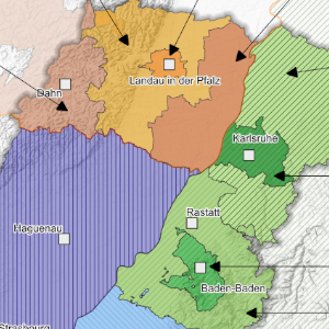
Political leaders of the main administrative territories of the Upper Rhine (January 2026)
This map proposes to discover, in the form of a trombinoscope, the different political leaders of the main administrative territories of the Upper Rhine.
Simple
- Date (Creation)
- 2022-10-01
- Date (Publication)
- 2022-10-24
- Date (Revision)
- 2026-01-21
- Citation identifier
- 10_2022_288
- Status
- Completed
- Point of contact
-
Organisation name Individual name Electronic mail address Role GeoRhena
GeoRhena
Processor
- Maintenance and update frequency
- Not planned
- Keywords
-
-
elected members
-
- Keywords
-
-
Map
-
- Keywords
-
-
Upper Rhine
-
- Use limitation
-
Licence CC BY
- Access constraints
- Other restrictions
- Use constraints
- Other restrictions
- Other constraints
-
No other limitation
- Denominator
- 100000
- Language
- Français
- Character set
- UTF8
- Topic category
-
- Boundaries
- Begin date
- 2025-08-01
- End date
- 2025-12-31
- Distribution format
-
Name Version PDF Map
-
Digital transfer options
- OnLine resource
-
Protocol Linkage Name WWW:DOWNLOAD-1.0-http--download
https://www.georhena.eu/sites/default/files/Cartes/10_2022_288.pdf Pdf Download
Metadata
- File identifier
- d7efd678-bc57-4648-a67f-6e02386abeb9 XML
- Metadata language
- Français
- Character set
- UTF8
- Parent identifier
-
Responsables politiques des principaux territoires administratifs du Rhin Supérieur
2fc47f5b-feac-411f-b1d5-89d4e0c6de3f
- Hierarchy level
- staticMap
- Hierarchy level name
-
Carte statique
- Date stamp
- 2026-01-21T08:19:02.174187Z
- Metadata standard name
-
ISO 19115:2003/19139
- Metadata standard version
-
1.0
- Metadata author
-
Organisation name Individual name Electronic mail address Role GeoRhena: Geographical Information System of the Upper Rhine
Author
- Other language
-
Language Character encoding German UTF8 English UTF8 French UTF8