 Catalogue DataGrandEst
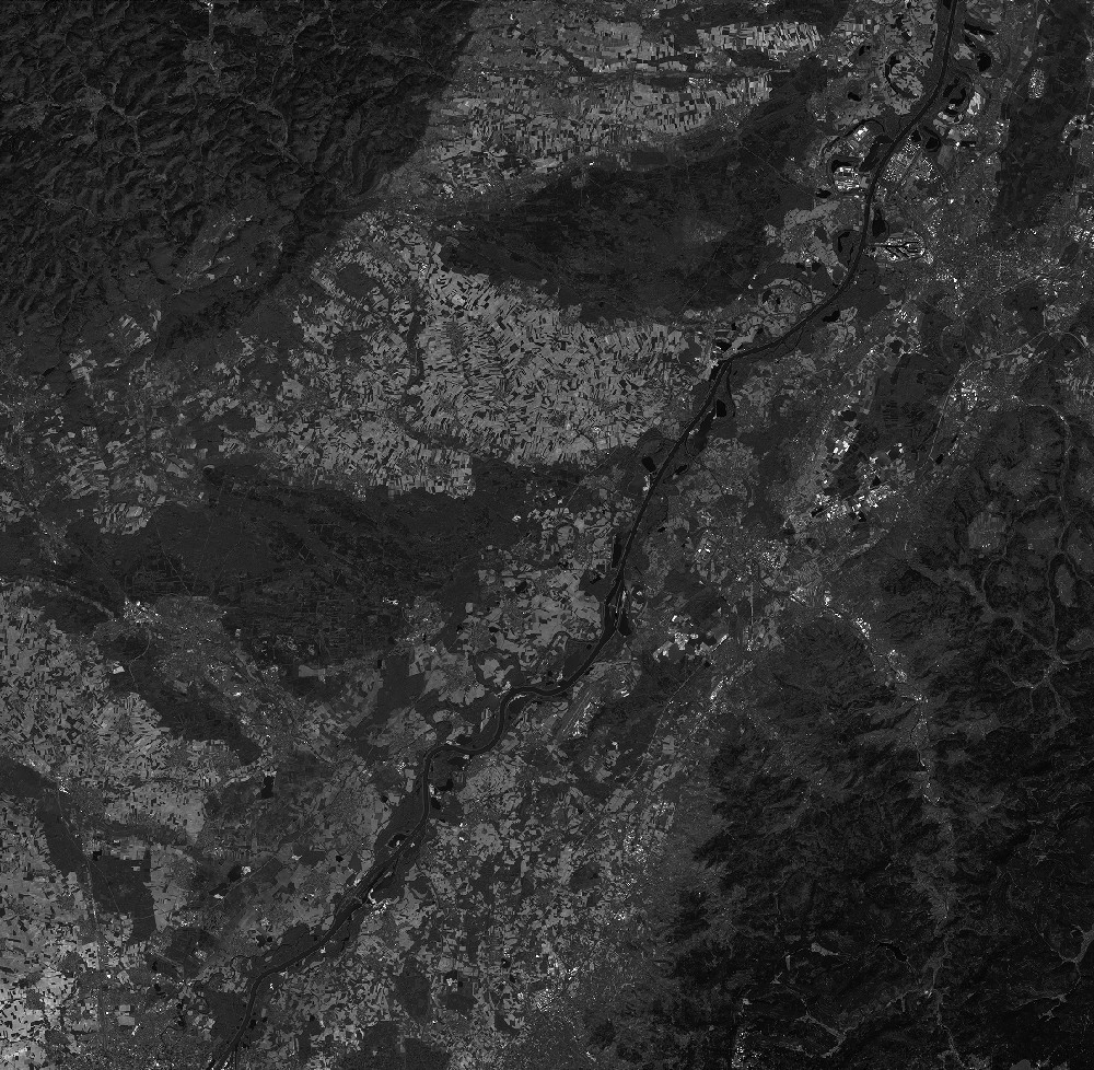
SPOT 7 PAN L1A 2015-04-22 10:05:53
L1A PAN image acquired by SPOT 7 on 2015-04-22 at 10:05:53
Simple
- Date (Creation)
- 2016-09-27T12:07:44Z
- Date (Publication)
- 2016-09-27T12:07:44Z
- Date (Revision)
- 2020-04-22T09:00:00Z
- Keywords
-
-
Dotcloud identifier: 2297368618951699
-
SRD GEOSUD / IRD
-
Irstea
-
IGN
-
End time: 2015-04-22T10:05:53Z
-
Resolution: 2.25 m
-
Alsace
-
Rheinland-Pfalz
-
Baden-Württemberg
-
Moselle
-
Lorraine
-
SPOT 7
-
KALCNES
-
Germany
-
PAN
-
Bas-Rhin
-
PMS
-
L1A
-
France
-
SPOT7
-
Europe
-
SPOT7_P_SENSOR_20150422_100553
-
eo_image
-
optical
-
Incidence angle: -8.1636 deg.
-
N
S
E
W
))
Digital transfer options
- OnLine resource
-
Protocol Linkage Name WWW:LINK-1.0-http--related
https://www.kalideos.fr/drupal/features/e5760510-fcbb-5074-9bba-c78089fa64f6 Description page
WWW:LINK-1.0-http--image-quicklook
https://www.kalideos.fr/map/products/20150422/2297368618951699/ql_2297368618951699.jpg Quicklook
WWW:LINK-1.0-http--image-thumbnail
https://www.kalideos.fr/map/products/20150422/2297368618951699/thumb_2297368618951699.jpg Thumbnail
WWW:LINK-1.0-http--license
https://www.kalideos.fr/map/products/Licenses/GEOSUD_SPOT67_2016_fr.pdf License
WWW:LINK-1.0-http--annexe
https://www.kalideos.fr/map/products/20150422/2297368618951699/annexes_SPOT7_P_SENSOR_20150422_100553/INDEX.HTM Annexe
Metadata
- File identifier
- e5760510-fcbb-5074-9bba-c78089fa64f6 XML
- Metadata language
-
en
- Hierarchy level
- Dataset
- Date stamp
- 2020-04-22T09:00:00Z
- Metadata standard name
-
ISO19115
- Metadata standard version
-
2003/Cor.1:2006
- Metadata author
-
Organisation name Individual name Electronic mail address Role Point of contact
)))
