Catalogue DataGrandEst
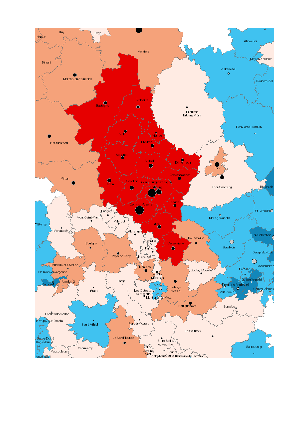
Average annual population growth rate 2000-2016
- Increase and decrease in population 2000-2016 (Lorraine: 1999-2015)
- Average annual growth rate of the population 2000-2016 (Lorraine: 1999-2015)
- Territorial entities: Cantons (LOR, LUX), Kreise (RLP, SL), arrondissements (WAL)
- Statistical data sources: INSEE Grand Est, Statistisches Landesamt Rheinland-Pfalz, Statistisches Amt Saarland, STATEC, IWEPS. Calculations: LISER 2018
- Geodata sources: ACT Luxembourg 2017, IGN France 2017, GeoBasis-DE / BKG 2017, NGI-Belgium 2017. Harmonization: SIG-GR / GIS-GR 2018
Simple
- Date (Creation)
- 2019-06-21T00:00:00
- Citation identifier
- / ff3da0d8-9ce1-4576-bee5-d7f8c3cf1401
- Presentation form
- Digital map
- Status
- Completed
- Point of contact
-
Organisation name Individual name Electronic mail address Role SIG-GR - Ministère de l'Energie et de l'Aménagement du territoire - Département de l'aménagement du territoire
Thierry Hengen
Author
- Maintenance and update frequency
- Continual
- Keywords
-
-
Population, average annual growth rate
-
-
Entités dans la Grande Région
-
-
Greater Region
-
-
gis-gr.eu themes
-
-
Demography
-
-
gis-gr.eu structure
-
-
Demography>Population change
-
- Keywords
-
-
gis-gr.eu
-
- Access constraints
- Other restrictions
- Spatial representation type
- Vector
- Denominator
- 250000
- Language
- Français
- Language
- English
- Language
- Deutsch
- Character set
- UTF8
- Topic category
-
- Society
))
- Reference system identifier
- EPSG / http://www.opengis.net/def/crs/EPSG/0/3857
- Distribution format
-
Name Version SHAPE
JPEG
PDF
Digital transfer options
- OnLine resource
Metadata
- File identifier
- ff3da0d8-9ce1-4576-bee5-d7f8c3cf1401 XML
- Metadata language
- Français
- Character set
- UTF8
- Hierarchy level
- Dataset
- Hierarchy level name
-
dataset
- Date stamp
- 2025-01-10T13:54:36
- Metadata standard name
-
ISO 19115:2003/19139
- Metadata standard version
-
1.0
- Metadata author
-
Organisation name Individual name Electronic mail address Role SIG-GR - Ministère de l'Energie et de l'Aménagement du territoire - Département de l'aménagement du territoire
Thierry Hengen
Point of contact
- Other language
-
Language Character encoding English UTF8 German UTF8 French UTF8
)))